Cape Kumukahi Black Sand Beach
Photo Gallery


About Cape Kumukahi Black Sand Beach on Hilo & East Island, Hawaii
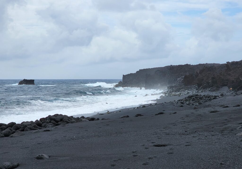
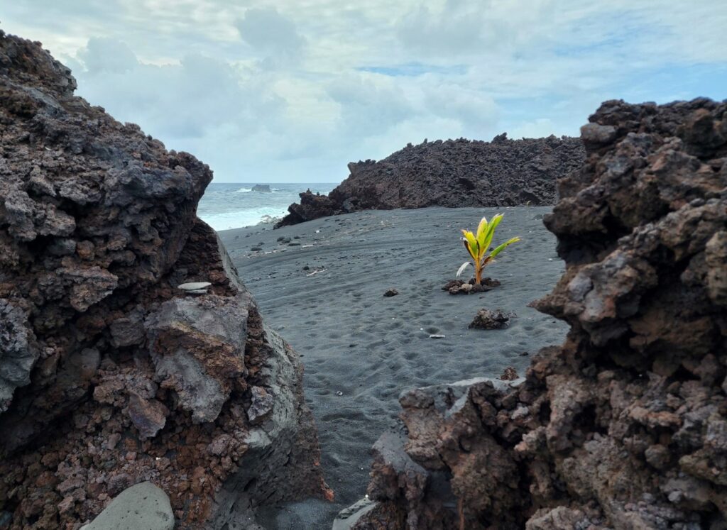
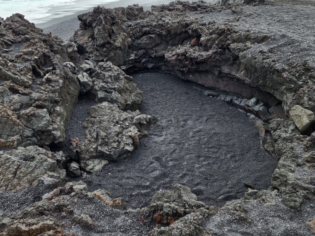
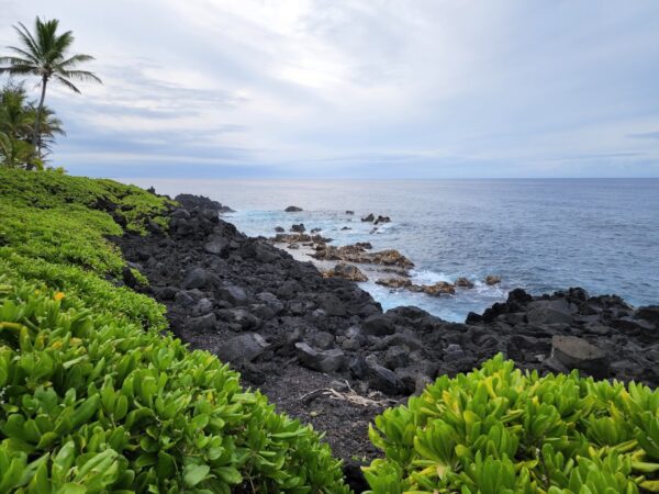
Cape Kumukahi is the easternmost end of the Big Island and an area that was covered in lava from the Kapoho Lava Flow of 1960. The Lower Puna Lava Flow of 2018 took over where the old flow left off by filling in Kapoho Bay and covering most of the land around it. While the area at the cape is pretty stark, you’ll find an historic light tower, ample solitude, and one of the newest black sand beaches on the island. The only catch is that now you have to hike about four miles round-trip.
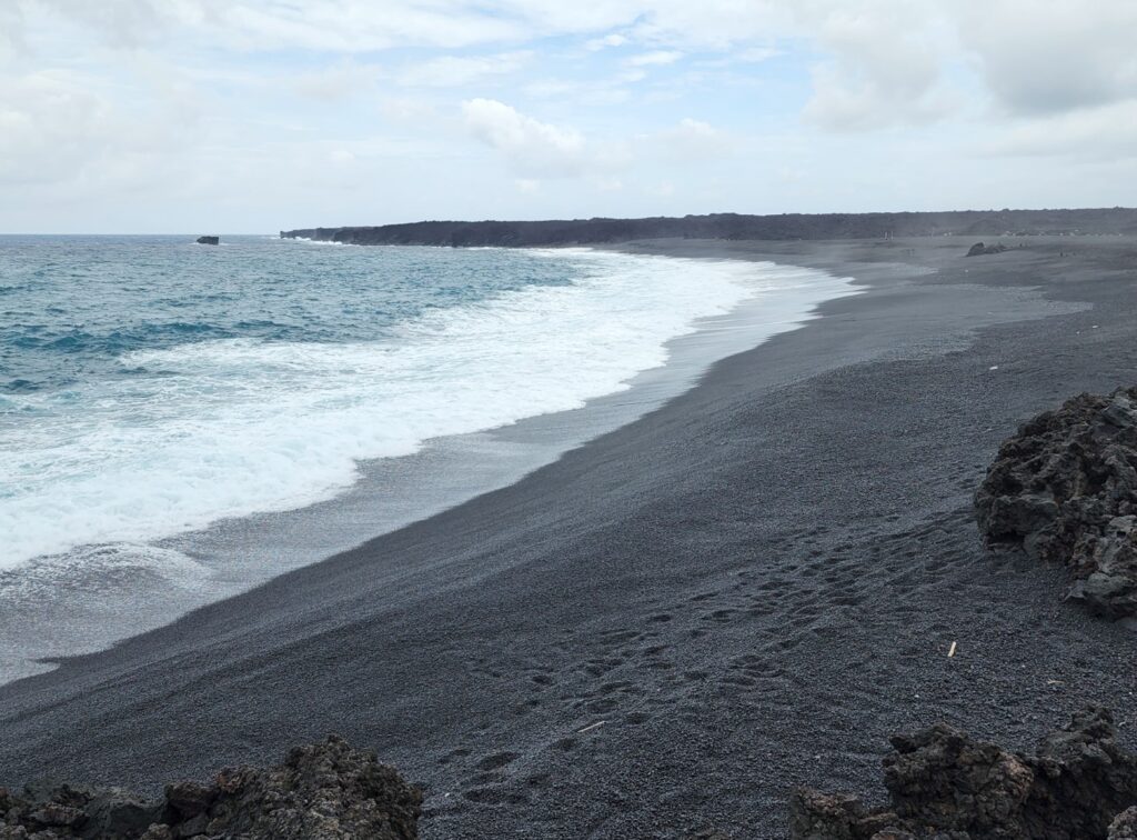
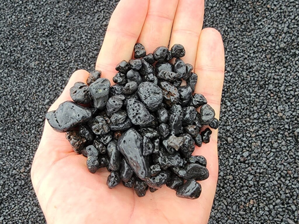
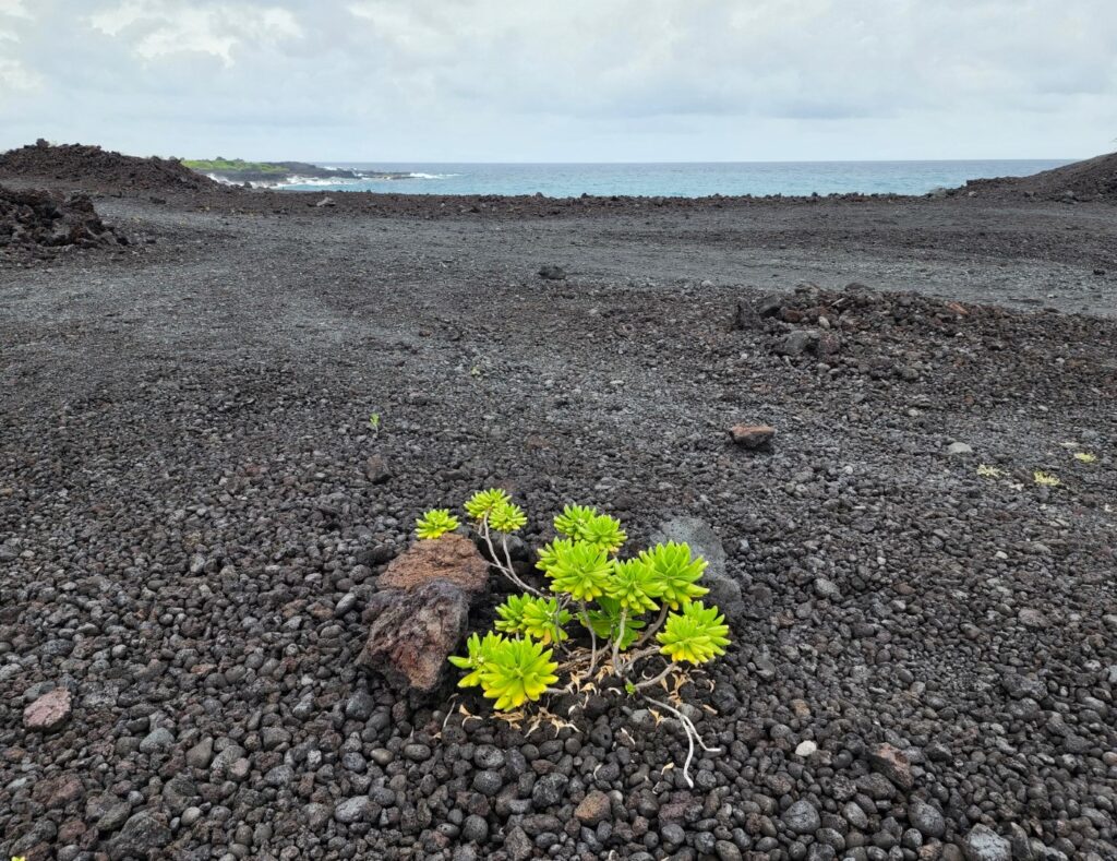
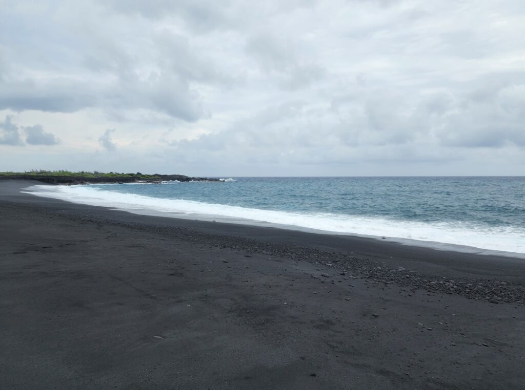
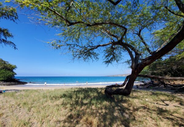
The black sand beach at Cape Kumukahi has formed since the 2018 lava flow in an area that was mostly a jagged lava rock shoreline. This new east-facing beach is about one-third mile long and has no shade. The old gravel roads directly behind the beach still remain, but the access to those roads were covered up therefore making it a “hike-in only” beach until the state replaces the vehicle access.
The intersection of Pahoa Kapoho Road (Hwy 132) and Government Beach Road (Hwy 137) has been reconstructed since the recent lava flow. This restores relatively easy access to Cape Kumukahi Road for foot traffic. Now it’s a two-mile long hike from the intersection to the new beach.
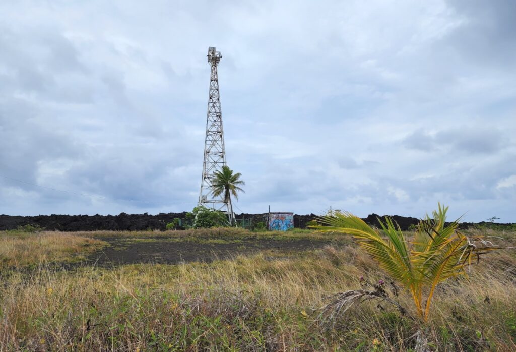
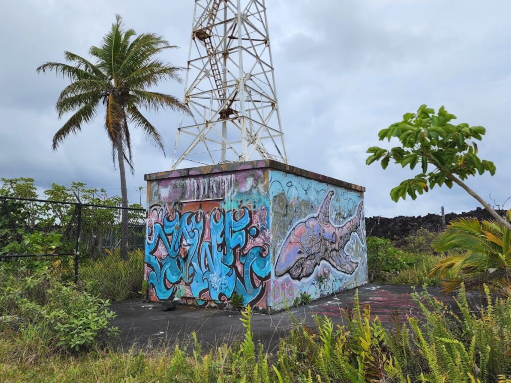
The Cape Kumukahi light structure isn’t a typical lighthouse. It’s a lattice/skeleton steel tower with a platform near the top that elevate the light to around 125 feet above the ground. The light tower was completed in 1934 and has been painted white to make it easier to see. It was somehow spared during the 1960 lava flow which came within mere feet on all sides of the base. The lightkeeper’s home and the other Coast Guard buildings were destroyed however. After that lava flow was over, the Coast Guard brought power lines to the light to automate it. Visitors can walk around the tower, but not get on it or go up it.
Getting to the trailhead is a long drive from just about any starting point on the island. See our map for the trailhead. Park near the intersection of Hwy 132 and Hwy 137 (now just a bend in the road) and climb eastward up over the lava. If it’s not foggy you should see the white light tower in the far distance. Follow a very rugged trail (ATV track) over the new lava toward the tower. Soon you’ll find the old level dirt road which heads straight to the light tower. From there, walk due south toward the ocean on a gravel road and you’ll find the new black sand beach to your right. It’s difficult to loop back to the access road so going back the same way you went in is the best plan.
- Address
- Government Beach Rd & HI-132
Pahoa, HI 96778 - Park Name
- Cape Kumukahi US Coast Guard Reservation
- Other Names
- Cape Kumakahi Light Beacon
- Owner
- Public
- Pet Details
- No signs discourage dogs on this hike or beach
- Fees
- Free parking
- Activities
- Hiking, Beach Exploration, Beachcombing
- Amenities
- Lighthouse Tower, Black Sand Beach

Nearby Beaches

Isaac Hale Beach Park (Pohoiki Beach)
3.8 miles away
Pohoiki Beach at Isaac Hale Beach Park is a rocky black sand shoreline that’s off the beaten track. The...

MacKenzie State Recreation Area
5.3 miles away
MacKenzie State Recreation Area is small forested and beachless state park on the coast of the Puna District. The...
Kahakai Park
5.3 miles away
Kahakai Park is a small county park on the shore of the housing subdivision known as “Hawaiian Beaches”. Despite...
Nearby Attractions

The Boiling Pots & Pe'epe'e Falls
21.8 miles away
The Boiling Pots and the triple waterfall known as Pe’epe’e Falls are a popular stop in the Hilo area....
Nearby Lodging
Reviews
Thank you for sharing this information. It was useful on our hike to the lighthouse today. I do want to add that currently the best way to access the atv trail is through the center of the graffiti barriers. It took us a moment to figure that out. There are currently white spray painted pineapples to guide you to the lighthouse road. It took us about 45 minutes to hike from two corners to the lighthouse. I would suggest starting early in the morning as it gets HOT as the day goes on. Enjoy!